Well, we're only a day behind with our posts and some of that is due to the fact that yesterday, Friday, was a long day "at sea." The weather cleared beautifully and we were able to get out to the largest of the Aran Islands, Inis Mor.
Sue couldn't pass up all the sunshine and so took 143 photos---but you'll only have to view 30 of her best.
At least we can cut back on the dialogue and have more photos to view. If the photos come out a little smaller, your computer screen didn't get smaller, it's due to a slow internet service again---so we switched to "medium-sized" photos instead of the larger ones.
Here's our ferry to the Aran Islands. We had a good crowd aboard---everybody must have been waiting for the good weather.

Some people must have been planning on coming regardless of the weather. We had a whole wedding party and guests---there are the two "flower girls" ready to go. The wedding party carried a huge box of flowers for the ceremony and two young ladies very carefully carried the wedding cake---a huge one-layer---in a shallow cardboard box about three feet square.
And thank you for all your prayers for a safe and successful journey, because we had a beautifully calm Atlantic Ocean and not a bit of "sea sickness"---hooray!
When we arrived at Inis Mor there were plenty of bicycles to rent, or jaunting carts, or tour vans. We left the mountain bikes to the young crowd and were worried the pony and carts would be too cool, so we opted for a van.
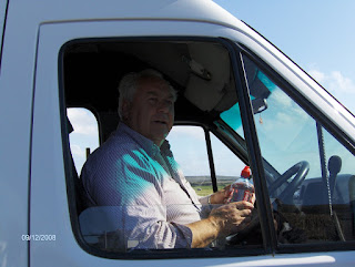
Here's our driver and tour guide, Bertie Flaherty. He's a life-long resident, one of the 825 there.
Here's Mr. Flaherty's Volkswagon van. We moved right along in spite of the narrow roads and squeezing by jaunting carts and the poor tourists on bicycles.
Here's the slower way to see the island with a lovely and open air venue. It would have worked well because the day was pleasant and warm, even though we were out in the Atlantic.
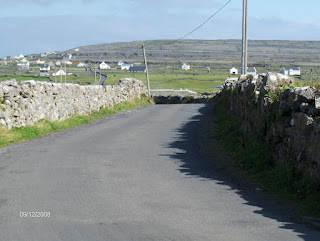
We were so glad Mr. Flaherty was driving instead of us in a rental car because the roads were basically one lane...
...with plenty of stone walls on each side of the road.
There were several lovely beaches as we drove around the island...
And some of the areas were ready for surfers as well. And we did have a group of about five young fellows with heavy Australian accents who came aboard the ferry with their own small, boogie boards.
Our first stop was at "The Seven Churches," were there was a large cemetery and the ruins of two churches.
A very pretty sight in a sheltered pocket of the island.
There were many, many tiny fields separated by rock fences. Most of it is used as grazing for cattle. The only reason there is soil and grass growing is because, as Mr. Flaherty explained, people carried up seaweed and sand from the shore to create a loamy soil after many years.
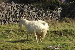
And, would you believe, we didn't see any sheep from which to get the wool to make the famous "Aran Sweaters." There was only this lone goat and...
...the rest were beef cattle. Apparently that's where the profit is for the few farmers on the island. (Perhaps they are shipping in the wool from China?)
There were quite a few "B and B's" like the one below to stay at, along with a couple of small hotels.
And, would you believe, they had a couple of gift shops, including ones that sold "Aran Sweaters."
There were only a few buildings that still had "thatched roofs." This one looks like they got behind on the weeding.
Our last stop was at "Dun Aengus," one of the ring forts built hundreds of years ago by the ancient Celts.
Here's a sketch of what the original fort looked like:
And the "twenty minute" walk must have been done by young healthy souls, because it took some of us a little longer on the long and winding path.
And part of the problem might have been the steep grade along part of the way.
And there was a rock wall along most of the pathway. Just a way to use some of the granite that makes up the island.
And as you can see, the stones hold together very well without any cement to hold them in place.
Here's more of the granite surface of the island where nobody hauled up seaweed and sand to make a field for grazing.
Finally we reached the fort at the highest point on the hill. Based on the climb alone, it must have been a very effective defense.
It was a beautiful sight once we got to the top. Here's the view to the southeast, towards County Clare.
And this is as close as we got to the edge, looking out west across the Atlantic towards you.
Here's the view to the northwest where the Atlantic hits the island a lot stronger and has caused a little erosion even though it's all granite.
And, in closing, we hope this photo below comes out on your computer as beautifully as it did for us as the afternoon sun was lighting up the Atlantic.
[Congratulations, you survived a 30-photo story. Well done.]
[We're on to Tralee in County Kerry for week three. We have a few "O'Keane/Keane" records to check on in the area and the week-long festival and horse races in the nearby town of Listowel.]


No comments:
Post a Comment